Grid Reference finder and Plotter (Google Maps)
This is a 'lite' version of other, more complicated, websites providing Grid Reference finding
The Grid Reference finder and Plotter has 3 main uses
- Plot multiple Grid references or Eastings/Northings on a Google Map
- Read a file of Grid references (Plus Descriptions) and plot them onto a Google map
- Zoom onto features on the google map and click them to find the grid reference and Easting/Northing
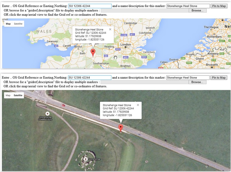
For example, SU 12306 42244, Is the Grid Ref. of the Heel stone at Stonehenge.
It is a 10 digit ref., therefore accurate to 1 metre.
Please note that 8 digit grid refs are accurate to 10m, with the grid ref being the south western point of the grid square.
6 digits accurate to 100m, 4 digits to 1km, etc.
Enter the grid ref, with a description and press 'Pin to Map', then zoom in and/or switch to Satellite Mode
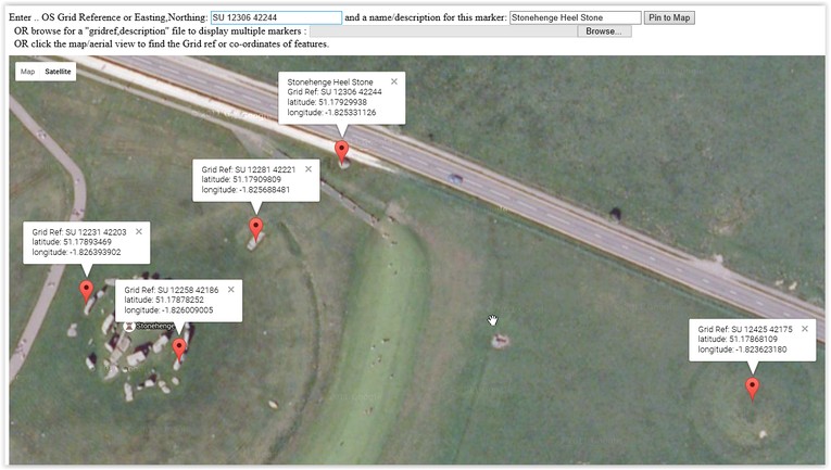
Then Click on other features in the landscape to find their grid references (click on the pin to get the text)
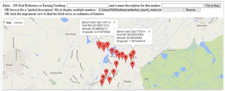
Finally, If you have a simple text file (created with, say, Notepad) containing lines of :
GridReferences, a comma, then a description
e.g
SD 9930 0999,Bench Mark 266.636 m
SD 9974 0979,Bench Mark 259.4732 m
SD 9998 0906,Bench Mark 289.2766 m
SD 9999 0968,Bench Mark 278.3769 m
SD 9919 0804,Bench Mark 222.8423 m
SD 9926 0830,Bench Mark 236.83 m
SD 9943 0861,Bench Mark 258.36 m
Then a whole sequence of grid references can be plotted using the 'file browser' facility
Click HERE for the Grid Reference Plotter
The grid ref plotter uses algoriths provided by the Ordnance Survey
These were converted to Javascript by Chris Veness (www.movable-type.co.uk)
and a simple prototype was written by Ian Develin (www.iandevlin.com)
Phil B.
© Quickmere 26/04/16